
Info about the trail 2018.
Download GPS file for 2018 trail
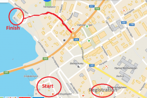
Start at Hembygdsgården in Strömsund
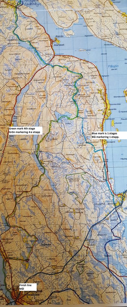
Stage 1 Start- wilderness chp. Gubbhögen, 85 km will start at Hembygdsgården in Strömsund as planned. The trail leads over Vattudalen (lake), where own trails will lead towards the scooter trails over Malmsjön (lake) and further up to the village of Lövberga, where we pass the road E45. After that the route continues on scooter trails passing Järvsand (village) and over Ritjelsberget (mountain) to Alanäset (village), with another road crossing over road 342. Further towrads Gubbhögen (village), where we’ll cross road 342 again and shortly after coming to wilderness checkpoint Gubbhögen.
Stages 2 wilderness chp. Gubbhögen – Chp. Norråker 1, 35 km From Gubbhögen via Siljeåsen (village) and Skansnäset (village) to Norråker. Contains a hilly part over the mountains.

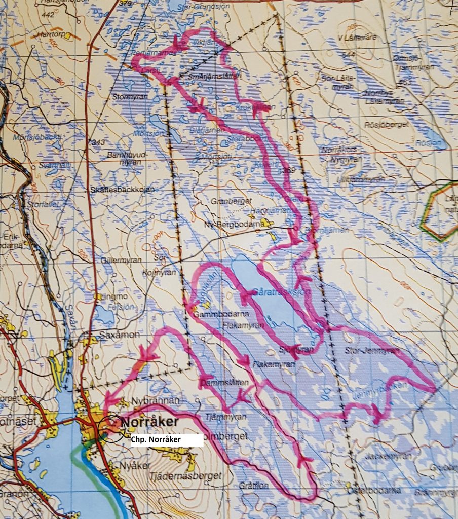
Stage 3 Chp. Norråker 1 – Chp. Norråker 2, 64 km: will run on an existing 50km trail around Norråker, with an extension that we’ll create north of the village.
Stage 4 Chp. Norråker 2 – Finish Strömsund, 103 km This stage will use the same route back to Skansnäset, Siljeåsen, Gubbhögen (look at map for stage 2) Alanäset and up Ritjelsberget again. From there we’ll take the scooter trails back to Strömsund which will most likely lead via Ursvattnet (lake), Järilvattnet (lake) and Nördsjön (lake). Contains a hilly part over the mountain again. Finish area at the northern beach side of Vattudal in Strömsund.
Finish area
With this new trail the total distance for Amundsen Race 2018 adds up to around 287 km.